The Old Chalk Way
Off-road riding has become more appealing to me in recent years, especially now that I ride a bike with tyres suited to rough surfaces and trails. The Old Chalk Way is a long distance, at least by UK standards, off-road trail that connects the south coast of England with the North Sea, 600km away on the Norfolk coast.
The route, also referred to as the Greater Ridgeway, has existed for centuries, connecting what are now marked as predominantly byways and bridleways on a map through rural England, passing many ancient burial sites and settlements, including the most famous and well-known - Stonehenge.
Naming it The Old Chalk Way is a reference both to its age and the fact that the underlying geology throughout much of the route is composed of chalk, a surface that allowed the route to be used throughout the year, particularly as much of it passes over higher land, hence naming it the ridgeway. I’d seen the route posted on a few sites before, and had it marked down in my wishlist of summer UK rides when I had a chance.
The route mostly follows this band of chalk from the south coast to the North Sea
The route is primarily made up of four marked trails through rural England: The Wessex Ridgeway, The Ridgeway, The Icknield Way and the Peddars Way. Aside from riding through the concrete jungle that is Luton, the route bypasses most urban areas and busy roads. For an area of the UK which is relatively densely populated, I found it surprisingly quiet.
Not the quietest part of the UK, but I found the trails surprisingly peaceful. Most of the UK public choose to travel everywhere by car.
I’ve cycled parts of this route before, but never in its entirety, so picked a good weather window at the end of August to set off. While the official route starts in Lyme Regis, my UK base in nearby Weymouth meant connecting with the Wessex Ridgeway further east. A detour to stay with my sister one night also meant the route shown below is not the exact marked trail, but I rarely follow routes precisely, preferring instead to find my own way. The advantage of a marked route like this, especially in the UK, is that there was never any worry about riding on a restricted trail. Land use and its ownership is always a contentious issue on this crowded little island. The Old Chalk Way has a lot of turn-by-turn navigation through fields and gates, so having it on a phone or GPS device to follow is really the best way, even if there is some signage in parts.
In terms of accommodation and logistics of food and water, I wild camped, as I predominantly do when travelling by bicycle in the UK. This is relatively easy throughout the route, although my second night on the Ridgeway I ended up in an exposed and windy spot. I was woken, (although hadn't really slept well as my tent was collapsing with the wind) by the sound of horses the following morning, camped as I was on what was a horse-race training field through which the trail passed. I peeped out of the tent to see a small number of wax jackets, horses and quad bikes. They ignored me, but not the best place to camp in hindsight. All other spots on my route I would recommend.
Some parts of the official route bypassed places where I needed to do some food shopping, so detours and wiggles in towns probably reflect that on the map above, usually to a Lidl or Aldi if one existed. The two cheapest UK supermarkets tend to be staple stops for me when cycling in the UK, not country pubs where a pint of beer is likely to cost in excess of £5, and a meal three times that amount! I find the UK increasingly expensive every time I am back in the country. The fact that this route rides through some of the most affluent parts of the country (quaint villages, large country houses, sports cars and range rovers parked on gravel drives) serves to remind me how very unequal wealth distribution is within the UK, but that’s a different story.
Weather wise the riding was perfect. In wet weather parts of this route would be very muddy, requiring a mountain bike, which is probably the best bike to use anyway, although gravel bikes with wide tyres would suffice. Just like most of the UK I would say April-October were the best months to ride, with the summer ones being ideal. As the predominant wind direction is from the south-west, I was very happy to have a tailwind throughout most of this ride.
The start of the ride was certainly more challenging in terms of elevation change than the latter. Dorset and Wiltshire have plenty of rolling hills, so the route is far from flat. About 55% of the route is off-road, the other 45% on quiet country lanes.
I took fewer photos than I normally would on this tour, partly because the landscapes and places are familiar, but I also did more filming. A short video at the end of this post gives a snapshot of how the ride is.
If you enjoyed this post and would like to show your support, please consider purchasing a virtual drink by clicking on the link below.
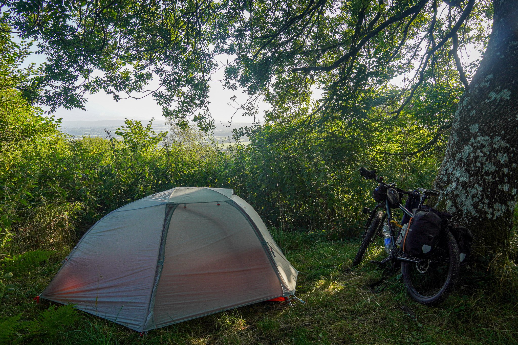
First night's camp in a woodland near Shaftesbury. And first night in a new tent. The Big Agnes Copper Spur is a two person free-standing tent. A separate blog post on tents is necessary to go into more detail on my choice and review of tents, but this one is light and very spacious.
Gold Hill, in Shaftesbury, one of southern England's most iconic streets, made famous by a bread advert. Cobbled and quite a steep climb on a loaded bike!
Camp on the second day. The grass was lush and soft, but a strong wind blew throughout the night, sending my tent pegs flying, flysheet flapping and when the poles dislodged themselves from the tent (I had foolishly staked them into the groundsheet and not the inner) it started to collapse. The sound of nearby galloping horses shortly after sunrise had me packed up pretty quickly. Not the best spot all in all, but that's wild camping for you.
A much better camp at the end of Day 4 near Luton, which is probably the most built-up area of the route. A gap in a hedge leading off the trail just before sunset turned out to be a great spot.
I packed relatively lightly for this trip. Tent and camping chair in red bag, sleeping quilt, mattress and clothes in one pannier, cooking stove and food in the other, with plenty of space left in each. I find using small panniers a far better solution, whatever the kind of surface and riding I am doing, than smaller bags like saddle and frame bags, which are restrictive in what you can fit in them and require more precision packing.
Stonehenge, back in the spring of 2021 when riding another off-road route - King Alfred's Way. I used a saddlebag and frame bag throughout that year, but went back to using panniers the following year,
Camp on Day 5. I had seen a large woodland on the map and had it pinned down as probably the best place to find some discreet and scenic to camp, which it was.
In cooler weather I usually try to pitch my tent facing east, so as to receive the morning sun. Another sunny day ahead here.
Riding the Peddars Way on day 6. There was a lot of woodland trails on this route, especially through the second half.
Lunch stop. My usual feed being tortilla wraps filled with hummus, salad and possibly some cheese/tinned fish.
Or possibly a bacon wrap, being made here at breakfast alongside my porridge.
Pasta and couscous are evening staples, usually with a tomato-based sauce.
End of the ride and beers with an old uni friend who had cycled up to meet me on the Norfolk coast from Norwich.
Last camp in more woodlands on the Norfolk coast.
Riding back to Norwich the next day. I continued back to Dorset over the coming days following paved roads, jumping on a few trains to speed the journey up.


